1982
Act
Information
of
Freedom
under
Released

2
From:
s47F, s22
To:
s22
Cc:
s47F, s22
xxxxxxxx@xxxxxxxxxxxxx.xxx.xx
Subject:
RE: YMHB Questions [SEC=UNCLASSIFIED]
Date:
Monday, 8 January 2018 2:10:58 PM
Attachments:
image001.gif
HB VOR-Z RWY30 Splay Comparison.pdf
MHBVO1-DRAFT7.pdf
Hi s22
Find below responses to the queries you raised regarding the Hobart pre-validation check.
Kind Regards,
s47F, s22
Airservices Australia
1982
s47F, s22
Act
airservicesaustralia.com
Website
Information
of
________________________________________________________________________________________________________________________________________
CAUTION: This e-mail is confidential. If you are not the intended recipient, you must not disclose or use the information contained in it.
If you have received this e-mail in error, please tell us immediately by return e-mail and delete the document.
Freedom
From: s47F, s22
under
Sent: Monday, 8 January 2018 11:04 AM
To: s47F, s22
@AirservicesAustralia.com>
Subject: YMHB Questions [SEC=UNCLASSIFIED]
Released
Hi s47
F
See responses to s22
points below:
s47F,
there are a few issues that I have mentioned in the checklist, namely:
22
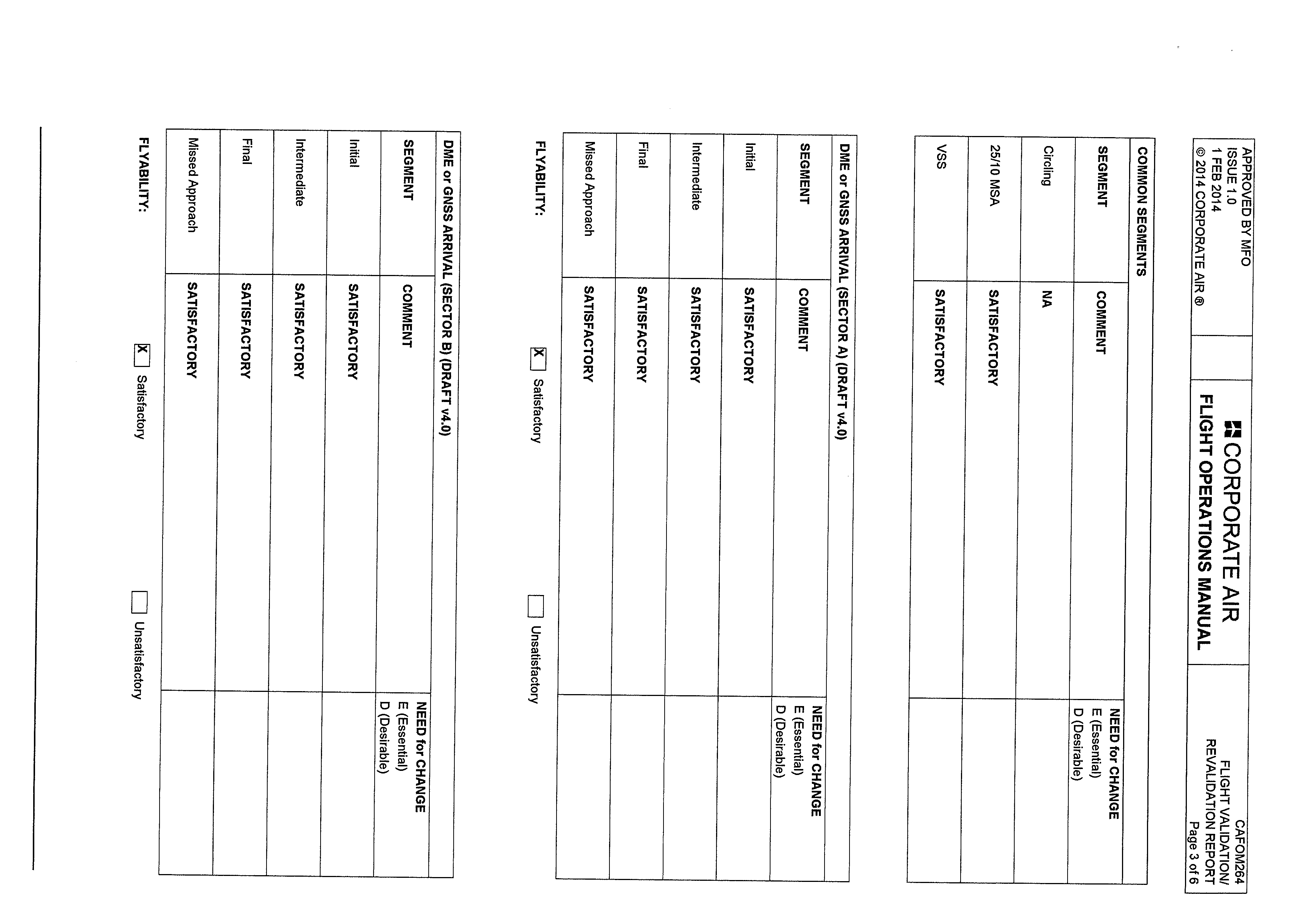
1. DGA Sector A circling minimum CAT A/B has been reduced from 1530’ to 1240’,
with no explanation on the design pro-forma. DGA Sector Broad - HB circling
minimum is 1750’, with no change and pro-forma has not been provided.
The Sector A CAT A/B minimum was reduced to match the circling A/B minimum,
due to re-assessment of terrain in the final segment after the 3 DME step. The
highest terrain identified after the 3 DME step (120m Contour) permits a
minimum as low as the CAT A/B circling minimum.
Previous assessment of this final segment used the 278m Trig (Mt Lord) as the
controlling obstacle, so the higher CAT C circling minimum was also used for CAT
A/B.
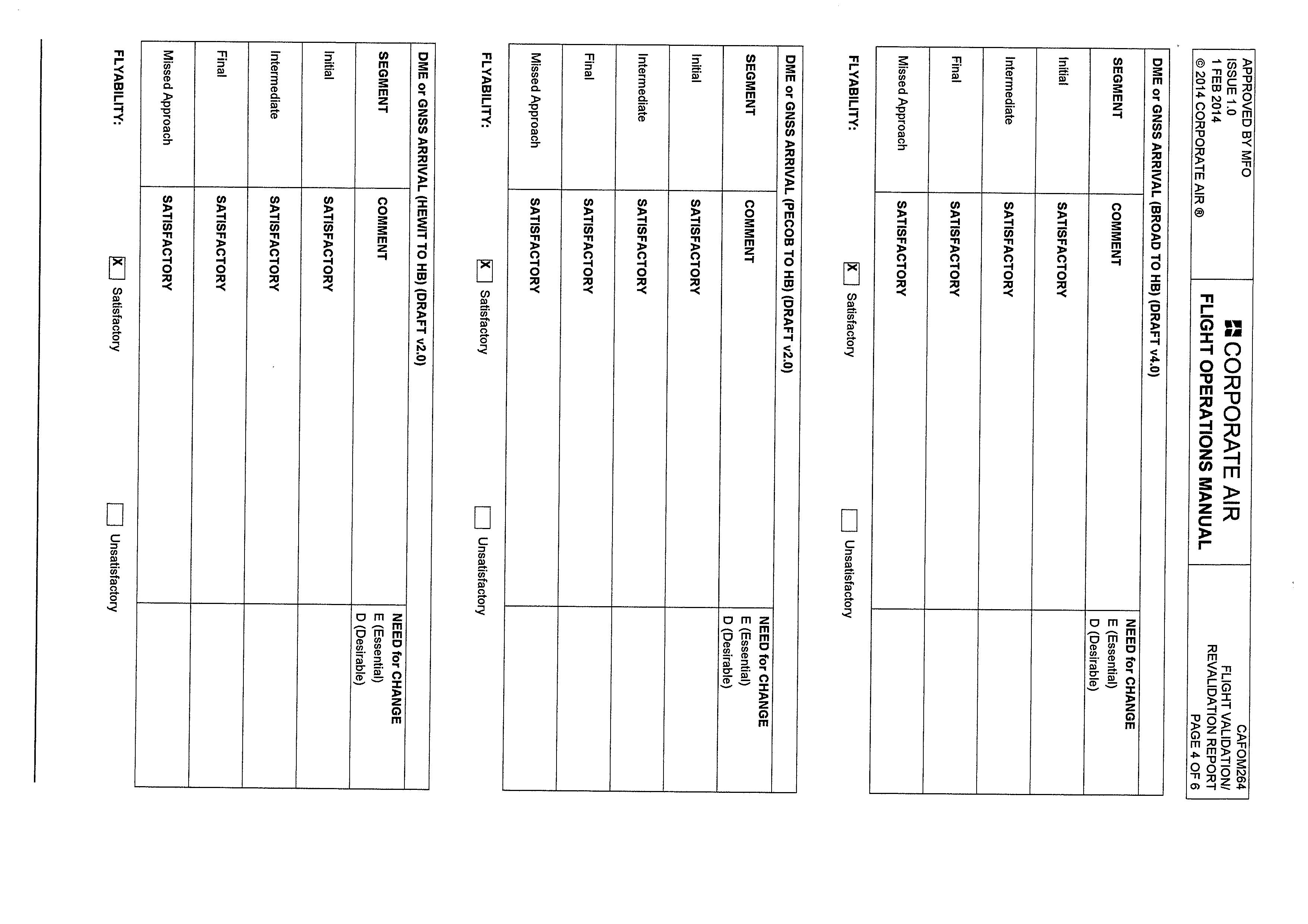
Regarding the BROAD-HB arrival, the previous design was retained in terms of
the minima, however the VPA was adjusted to 3° to standardise with the other
arrivals. A proforma for this arrival was provided in the original email requesting
flight validation.
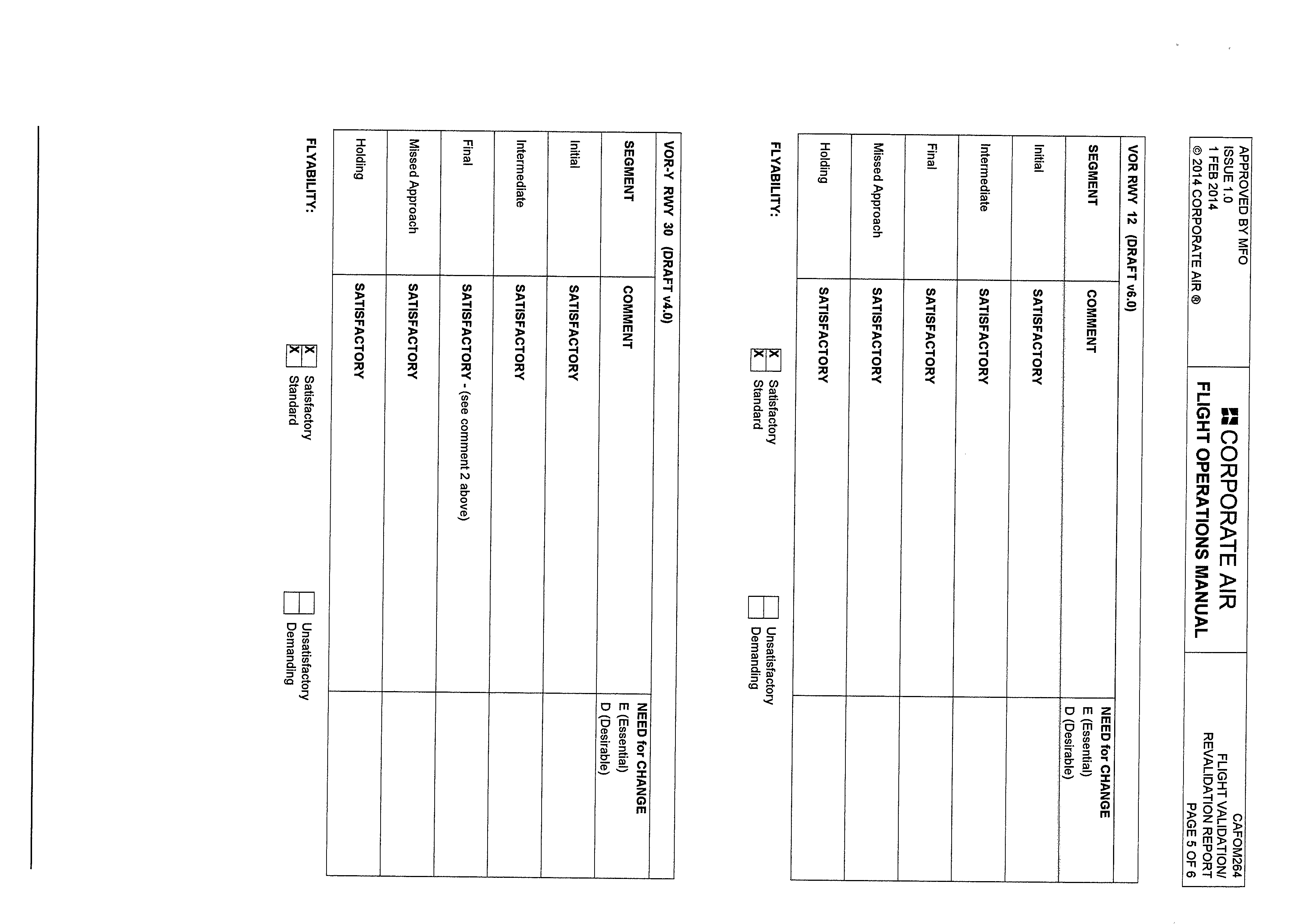
2. VOR RW 12 (editorial):
o On the profile view the depiction of inbound turn is inconsistent with
similar approaches.
o On the profile view recommend adjusting the outbound track a little
higher to keep it clear of the 4130’ crossing altitude.
1982
Agree with both points in regards to the reversal depiction, find attached the
updated chart (v7.0) with amendments to the profile view.Act
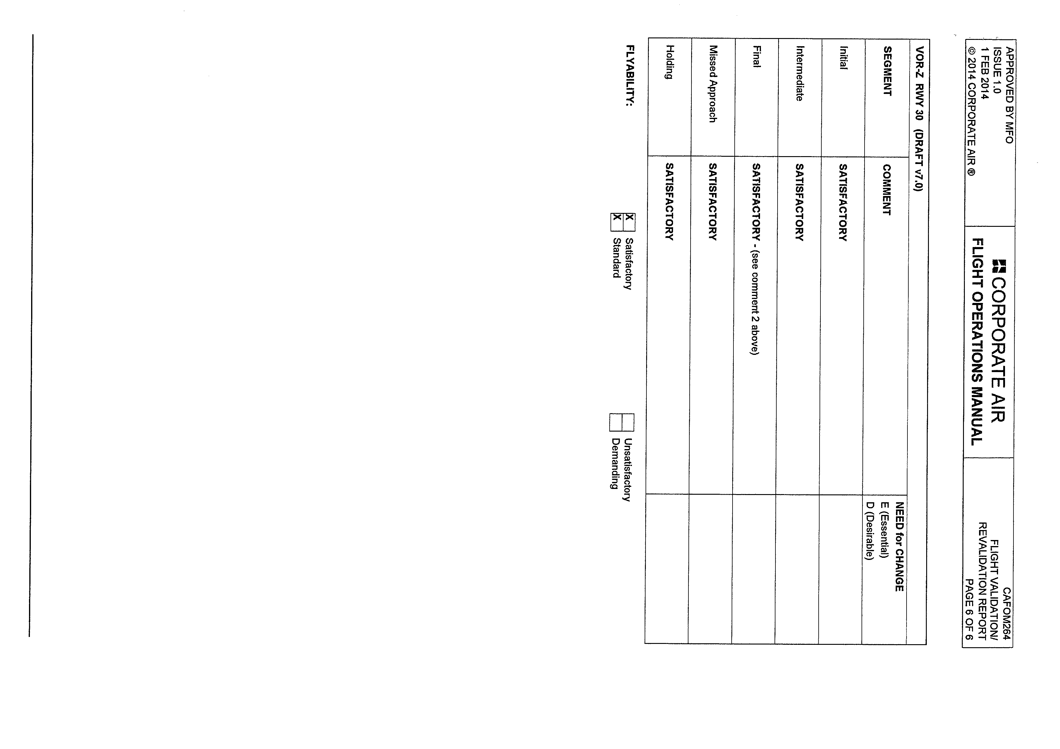
3. VOR-Z RW 30: MDA for 2.5% MAP gradient is required.
The published MDA of 660 assumes a 2.5% MAP gradient. The reason we haven’t
also published an MDA with a higher MAP gradient is that the difference is no
Information
longer significant (600ft vs 660ft), unlike the previous design.
of
The standard MDA (2.5% MAP Gradient) has been reduced significantly from the
previous design because of the lateral movement of the VOR and therefore the
entire procedure. The controlling terrain in the missed approach of the new
design is much closer to the outer edge of the secondary area, so a lower MOC
Freedom
could be used. Please referred to the attached PDF.
under
4. VOR-Y RW 30: Pro-forma indicates that 4.5% MAP gradient is required for CTA
containment but this is not noted on chart.
o Review whether an MDA for 2.5% MAP gradient should also be
published.
The gradient required for CTA containment is not noted on the chart because it
Released
is less than 5%. The note in MOS Part 173 8.1.1.4 (c) stipulates that only
gradients greater than 5% need to be identified on the chart which is consistent
with how we depict missed approaches on other procedures within controlled
airspace.
Regarding the second point, the MDA published on the chart is for the 2.5% MAP
gradient; we just haven’t published an MDA for 4.5%, unlike the previous design.
5. There are discrepancies in the pro-forma regarding the elevation of Mt Lord.
Different calculations use 278m Trig, 260m Contour + 20m, and 280m Contour +
20m.
A review of the hard copy maps found that a 280m contour is printed which was
not immediately obvious on the scanned version. Accordingly, affected proforma
pages have been updated using 280m for calculations.
Regards,
s47F, s22
Airservices Australia
s47F, s22
e s47F, s22 @airservicesaustralia.com
1982
Act
Information
of
Freedom
under
Released


3
From:
s22
To:
s47F, s22
Cc:
s47F, s22
; xxxxxxxx@xxxxxxxxxxxxx.xxx.xx
Subject:
RE: YMHB Questions [SEC=UNCLASSIFIED]
Date:
Monday, 8 January 2018 3:31:52 PM
Attachments:
image001.gif
image002.png
image003.png
image004.png
image005.png
UNCLASSIFIED
Hi s47F, s22
Thanks for the responses – that all makes sense.
Regarding the VOR 12 procedure turn – just a suggestion - can you show the turn on the profile
1982
view as well, a bit like the old chart?
Act
Cheers, s22
s22
Air Navigation, Airspace and Aerodromes Branch
CASA\Aviation Group
Information
s22
of
www.casa.gov.au
Freedom
under
From: s47F
@AirservicesAustralia.com]
Sent: Monday, 8 January 2018 2:11 PM
To: s22
Cc: s47F
; xxxxxxxx@xxxxxxxxxxxxx.xxx.xx
Subject: RE: YMHB Questions [SEC=UNCLASSIFIED]
Released
Hi s22
Find below responses to the queries you raised regarding the Hobart pre-validation check.
Kind Regards,
s47F, s22
Airservices Australia
s47F, s22
airservicesaustralia.com
1982
Act
Information
of
Freedom
under
Released
3. VOR-Z RW 30: MDA for 2.5% MAP gradient is required.
The published MDA of 660 assumes a 2.5% MAP gradient. The reason we haven’t
also published an MDA with a higher MAP gradient is that the difference is no
longer significant (600ft vs 660ft), unlike the previous design.
The standard MDA (2.5% MAP Gradient) has been reduced significantly from the
previous design because of the lateral movement of the VOR and therefore the
entire procedure. The controlling terrain in the missed approach of the new
design is much closer to the outer edge of the secondary area, so a lower MOC
could be used. Please referred to the attached PDF.
4. VOR-Y RW 30: Pro-forma indicates that 4.5% MAP gradient is required for CTA
containment but this is not noted on chart.
o Review whether an MDA for 2.5% MAP gradient should also be
published.
1982
The gradient required for CTA containment is not noted on the chart because it
is less than 5%. The note in MOS Part 173 8.1.1.4 (c) stipulates that only
Act
gradients greater than 5% need to be identified on the chart which is consistent
with how we depict missed approaches on other procedures within controlled
airspace.
Regarding the second point, the MDA published on the chart is for the 2.5% MAP
Information
gradient; we just haven’t published an MDA for 4.5%, unlike the previous design.
of
5. There are discrepancies in the pro-forma regarding the elevation of Mt Lord.
Different calculations use 278m Trig, 260m Contour + 20m, and 280m Contour +
20m.
Freedom
A review of the hard copy maps found that a 280m contour is printed which was
not immediately obvious on the scanned version. Accordingly, affected proforma
under
pages have been updated using 280m for calculations.
Regards,
Released
s47F, s22
Airservices Australia
s47F, s22
s47F, s22
airservicesaustralia.com
1982
Act
Information
of
Freedom
under
Released
1982
Act
Information
of
Freedom
under
Released
1982
Act
Information
of
Freedom
under
Released
1982
Act
Information
of
Freedom
under
Released
1982
Act
Information
of
Freedom
under
Released
1982
Act
Information
of
Freedom
under
Released